
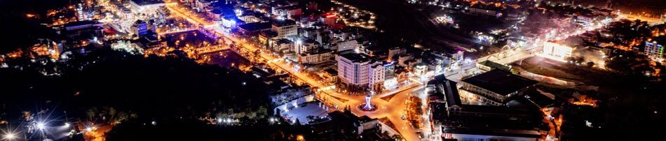
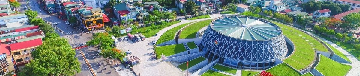

Điện Biên Phủ ward rests snugly within the basin, embraced naturally by mountain ranges, while familiar arterial routes connecting residential, administrative, and service areas remain as they have always been. Yet the longer one gazes, the easier it is to recognize that this is not merely a scene of memory, but a space opening up through a fresh perspective - broader, multi-layered, and rearranged within current developmental thinking.
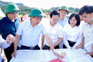
Điện Biên is a mountainous border province spanning approximately 9,541 km², with a population of over 670,000 and a border stretching more than 455 km adjacent to Laos and China. Against this spatial backdrop, the provincial Planning for the 2021-2030 period has gradually established a development framework, shaping dynamic axes and organizing space toward a center-satellite model. With the planning adjustment under Decision No.359/QĐ-UBND dated February 28, 2026, the essential point is not a shift in development goals, but rather an adjustment in approaching mindset: space is no longer merely allocated, but viewed as a system capable of better linkage and unified operation.
.jpg)
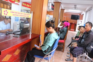
Reflecting on an earlier phase, it becomes evident that Điện Biên has long exhibited a rather distinct natural differentiation in its development space. Điện Biên Phủ ward maintains the role of administrative and service center, serving as the nuclear urban area of the province. However, venturing further away from the basin toward highland districts such as Mường Nhé, Nậm Pồ, Tủa Chùa, or Mường Chà, the developmental rhythm shifts gradually. Distances from the center to remote highland districts span up to hundreds of kilometers across winding mountain passes, causing natural disparities in infrastructure, service, and market accessibility among regions.
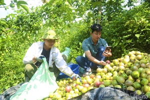
Amidst this context, each locality has forged its own path of development, relying heavily on internal strengths and natural conditions. Some lean toward agriculture, others depend on forestry, while certain areas experience stronger commercial and service growth to a limited degree. Space thus bears a pronounced “cluster” nature, with developmental patches existing relatively independently - accurately reflecting the characteristics of a vast mountainous border province with heavily dissected terrain and an uneven historical development path.
Looking back is not for comparison, but to grasp the natural foundation of modern planning thinking: once spaces have formed with distinct characteristics, the challenge lies not in making them identical, but in creating conditions for them to connect more effectively.
In the new planning adjustments, Điện Biên is perceived as a multi-layered spatial system where functional zones are placed in connected relationships rather than isolation. Điện Biên Phủ ward and Mường Thanh continue to serve as the development nucleus while acting as central nodes within a network linking surrounding spaces. The roles of agricultural, ecological-tourism, border, and urbanized zones are more clearly defined, bound together by infrastructure axes and development corridors.
.jpg)
The critical shift lies in the mindset of organizing space toward interconnectedness. Urban areas are no longer mere concentrations of services, but transform into radiating points. Rural areas are no longer confined to production spaces, but integrated into value chains. Tourism spaces go beyond landscape exploitation to engage with historical and cultural depth. Border areas carry not only geographical significance but also strategic weight tied to sustainable development and long-term stability. When these spatial layers are placed within a connected structure, Điện Biên transitions gradually from point-based development to network-based development.
Within this grand totality, spanning nearly ten thousand square kilometers, individual regions would easily operate as isolated “sub-spaces” without connectivity. Yet once linked via infrastructure, economic corridors, and dynamic axes, the entire space begins to function as a unified entity where regional differences are not erased, but arranged within a more rational structure of mutual support.
Naturally, a lag always exists between planning and daily life. Highland roads continue to improve, production spaces remain in transition, and inter-regional linkages require time to solidify.
Yet precisely through this process, a clear shift in developmental thinking is palpable: moving from viewing each area in isolation to perceiving the entire space as an organically connected system.
To me, standing at the Victory Monument and looking down at the basin today, the most striking element is not the visual transformation, but the expansion in how Điện Biên is conceptualized. A space once viewed through disjointed fragments is gradually understood as a reconnecting whole - not to become something else, but to operate more fully within its inherent values, representing a Điện Biên more unified in spatial thinking yet entirely faithful to the identity of a historic land.
Chí Nghĩa

.jpg)
.jpg)
.jpg)
.jpg)
.jpg)
.jpg)
.jpg)
.jpg)
.jpg)
.jpg)
.jpg)
You have 500/500 characters left
Please enter 5 or more characters!!!