
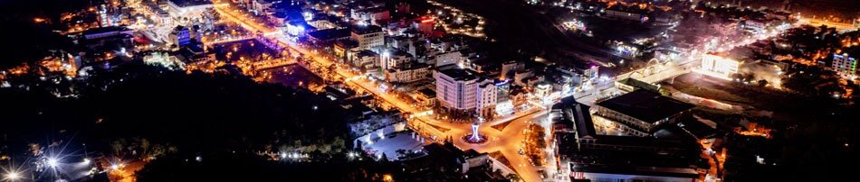


In the context of increasingly complex climate change developments, improving forecasting quality combined with promoting digital transformation and strengthening natural disaster prevention and control capacities is becoming a core task of the province.
In recent years, to meet the set requirements and tasks, the provincial Hydro-Meteorological Station has modernized and automated its observation and information transmission systems, while applying science and technology to shorten forecasting times and improve the accuracy of bulletins. In particular, the observation system has been comprehensively invested in, consisting of automatic equipment such as rain gauges, anemometers, thermometers, and hygrometers that operate 24/24 hours, ensuring that data is continuously transmitted in real time.
Notably, the weather radar system allows for the early detection of thunderstorm cloud regions forming from the Việt Nam - Lào border area and moving in from Lai Châu and Sơn La provinces, issuing timely warnings. This contributes to enhancing the quality and efficiency of meteorological bulletins.
.jpg)
The provincial Hydro-Meteorological Station has also proactively exploited and integrated multiple advanced forecasting models, such as GSM (Japan), GFS (USA), and IFS (European Centre for Medium-Range Weather Forecasts - ECMWF), combining high-resolution satellite cloud imagery with data from the National Center for Hydro-Meteorological Forecasting. Thanks to this, warning bulletins for heavy rain, thunderstorms, tornadoes, flash floods, and landslides have become increasingly close to reality.
According to Director of the provincial Hydro-Meteorological Station Trần Thị Phương Hoa, the application of technology is always given special attention by the unit. She noted that each year, the station issues over 1,000 weather forecast bulletins. With such a large volume of bulletins, the station has strengthened connections and data sharing with central agencies to enhance accuracy. During the rainy and flood season, bulletins are continuously updated on an hourly basis, helping the locality respond in a timely manner.
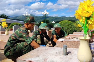
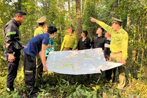
The effectiveness of forecasting work is increasingly demonstrated at the grassroots level as local party committees and authorities proactively receive information and quickly deploy natural disaster prevention plans. Vice Chairman of the Na Son commune People’s Committee Nguyễn Thanh Lâm stated that thanks to regularly updated forecast and warning information, the locality has reviewed and urgently relocated households out of dangerous areas when extreme weather patterns appear, while arranging forces on duty 24/24 hours to be ready to respond to unfolding situations. Typically, during the heavy rain from the night of July 31 to the early morning of August 1, 2025, more than 100 households at risk of being affected by landslides were urgently evacuated along with their property to safe places, thereby minimizing losses and especially preventing any casualties.
However, climate forecasting and warning work still face many difficulties due to the province’s heavily dissected terrain. Many remote and isolated areas do not have observation stations yet, so detailed forecasting for each specific point remains limited, especially for fast-occurring phenomena like torrents and flash floods. Besides, public access to information in some places is still constrained due to unsynchronized telecommunications infrastructure.
This reality requires diversifying information transmission channels while strengthening coordination among forecasting agencies, local authorities, and residents. Currently, warning bulletins are regularly published and broadcast on the Điện Biên Newspaper and Điện Biên Radio and Television, as well as posted on digital platforms and social networks. Many localities maintain loudspeaker systems broadcasting in ethnic minority languages and establish community Zalo groups to promptly inform residents.
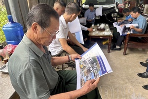
As a result, information reaches the public faster, and awareness of natural disaster prevention has been step-by-step raised. Sùng A Thành from Pàng Dề B village, Sáng Nhè commune, shared that in the past, they mainly assessed the weather based on experience, but now, forecast information via multiple channels like commune and village Zalo groups, loudspeakers, and television is highly accurate, so his family proactively monitors it. When there is heavy rain, they limit going to upland fields and stand ready to relocate if necessary.
According to the provincial Hydro-Meteorological Station, the forecast for 2026 continues to harbor many dangerous and extreme weather phenomena, such as heatwaves, short-duration high-intensity heavy rains, thunderstorms, tornadoes, lightning, hailstorms, flash floods, and landslides, setting an urgent requirement to improve the quality and timeliness of hydro-meteorological forecasting work. On that basis, Điện Biên province is step-by-step perfecting the process from forecasting and warning to responding in a people-centered direction, while effectively combining traditional experience with modern technology and promoting the role of digital platforms in providing information.
In the context of climate change trending toward highly complex developments and diverse disaster patterns, proactive prevention and risk mitigation have become core tasks. Through accelerating the application of science and technology, promoting digital transformation, and raising community awareness, Điện Biên is step-by-step enhancing its response capacity, contributing to protecting the lives and property of the people.
Phương Dung

.png)
.jpg)

.jpg)
.jpg)
.jpg)

.jpg)
.jpg)
.jpg)
.jpg)
.jpg)
You have 500/500 characters left
Please enter 5 or more characters!!!