
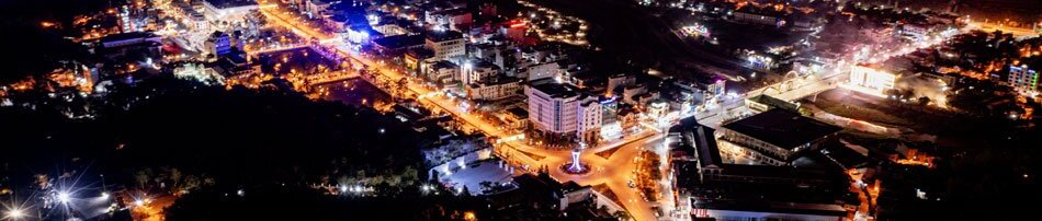


Điện Biên province has implemented land inventory tasks synchronously, integrating administrative restructuring, technological applications, and data standardization to create a vital foundation for effective and transparent land-use planning.
.jpg)
The total natural area of the province exceeds 954,803ha, though there is a significant disparity in size between localities. Sín Thầu commune is the largest, accounting for 5.42% of the provincial area, while Mường Thanh ward is the smallest at just 0.29%. Through the inventory process, the agricultural land group, comprising annual and perennial crops, forestry, and aquaculture, accounts for over 887,945ha, or 93% of the natural area. Non-agricultural land covers more than 27,982ha, representing 2.93%, while unused land stands at 38,875.43ha, accounting for 4.07%.
Within the agricultural group, land for annual crops spans over 435,930 ha, making up 45.66% of the natural area. This group is crucial for food security, requiring the inventory to be “correct” down to every land type and parcel to reflect actual production. Other annual crop land covers 347,345ha and is widely distributed, demanding a “sufficient” inventory process that is comprehensive and leaves no small or scattered areas behind. Perennial crop land covers more than 18,952ha, or 1.98% of the natural area. Despite its small proportion, this land holds high economic value as it is tied to industrial and fruit tree development. Accurately determining the current usage status of this group provides a basis for the province to adjust its agricultural development strategy toward higher value.
Regarding the vast forestry land area of over 430,349ha, these regions serve as more than just a resource for economic development; they play a particularly vital role in ecological protection, maintaining climate balance, and conserving biodiversity, especially in mitigating the impacts of natural disasters. Consequently, the requirements for the inventory and statistics of forestry land must be executed strictly, scientifically, and synchronously to serve as a foundation for the planning, management, and sustainable use of forest resources in the coming period.
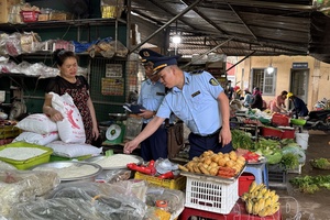
Beyond mere inventory, Điện Biên province is aggressively implementing a campaign to enrich and clean land databases following Plan No.4997/KH-UBND dated September 19, 2025, by the provincial People’s Committee. This is identified as a breakthrough in the digital transformation of the land sector, aiming for a data system that is “correct, sufficient, clean, living, unified, and shared.” The implementation scope covers all 45 communes and wards, focusing on reviewing, updating, and adjusting all data while collecting and digitizing information for land use rights certificates and housing that have been issued but not yet entered into the system.
.jpg)
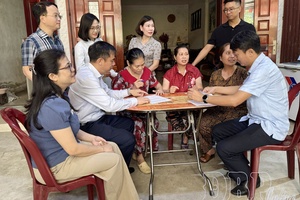
The objectives of the plan are clearly defined as enriching and cleaning the land database to ensure completeness, synchronization, accuracy, and timeliness, thereby effectively serving state management and improving the quality of public services for citizens and businesses. With the motto “going to every alley, knocking on every door, and checking every plot,” localities have established mobile task forces to directly reach households to promote awareness and guide the declaration, collection, and verification of information regarding land use rights and ownership of houses and assets attached to land.
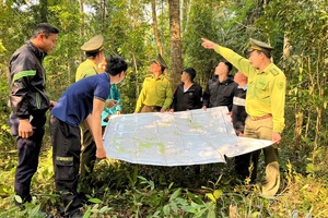
Recognizing that land review and inventory following the implementation of two-tier local government is a key task, Pú Nhung commune proactively developed a systematic implementation plan and mobilized the entire political system. Based on a clear assignment of people, tasks, and responsibilities, each official in charge of an area has worked closely with the grassroots to review every plot and land type, ensuring the data collected is complete, accurate, and realistic. During the process, the commune focused on combining the review of archived records with field inspections, while also stepping up communication efforts to raise public awareness about the significance of land inventory.
As a result, Pú Nhung became the first commune in the province to complete the land data cleaning campaign. The commune was tasked with reviewing 236 certificates of land use rights and ownership of houses and assets. The commune steering committee organized meetings and developed specific plans, and through determination, creative initiatives, and a high sense of responsibility, the 90-day campaign in Pú Nhung commune was completed in just 54 days.
With the goal of building a provincial land database that connects synchronously with national and sector-specific systems, the province has focused heavily on enriching and cleaning data recently. By March 30, the province had measured and mapped 55,807.35ha out of the total 281,579.59ha required across 18 of 45 communes and wards. The construction of the cadastral database has been implemented in 8 of 45 communes and wards, reaching 17.8%. Land registration and certificate issuance continue to be prioritized, with 144,979 out of a total of 1,684,196 land parcels now having issued certificates.
.jpg)
Practical implementation shows that “correct” is a consistent requirement reflected in the accurate identification of each land type, user, and administrative boundary. “Sufficient” ensures that no area is missed, even in remote or difficult-to-access regions. “Clean” is the process of removing discrepancies and standardizing data to ensure transparency and long-term utility. These three elements are closely linked, creating the overall quality of land inventory. When land data is integrated with national databases, its value extends beyond management to facilitate socio-economic development, from planning and investment to tax management and public services.
The three factors of “correct, sufficient, and clean” are now expanding into a higher value system that includes “living, unified, and shared.” “Living” means data is constantly updated to reflect current status; “unified” refers to synchronization across levels and sectors; and “shared” is the ability to exchange and utilize data for various purposes. This is the foundation for building a modern, transparent, and efficient land data system. With high determination, Điện Biên province is focusing on decisive and synchronous leadership to complete the set goals.
The results of the land inventory and the data enrichment campaign not only enhance the effectiveness of state management but also create an important platform for the province and the country to complete a modern national land database for sustainable development in the new era.
Thu Phương
.jpg)
.jpg)
.jpg)
.jpg)
.jpg)
.jpg)
.jpg)
.jpg)
.jpg)
.jpg)
.jpg)
.jpg)
You have 500/500 characters left
Please enter 5 or more characters!!!