


According to the Điện Biên provincial Department of Natural Resources and Environment, none of the communes and wards in the province have yet fully built a land database. Only 8 out of 45 communes and wards have established cadastral data systems.
Specifically, Điện Biên Phủ and Mường Thanh wards (in the former Điện Biên Phủ city) have managed and operated 55,373 land parcels through the Vilis 2.0 software. The communes of Tủa Chùa, Sín Chải, Tủa Thàng, Sính Phình, and Sáng Nhè have cadastral databases covering 169,748 parcels, but these have not yet been put into operation due to a lack of infrastructure, equipment, and training. Meanwhile, Mường Lay ward is operating its cadastral data system on the VBDLIS platform, managing 16,987 land parcels.
These shortcomings in developing and managing land data have led to land disputes, complaints, and reduced transparency in the real estate market. The lack of integration with the national population database makes it difficult to verify land users, while overlapping procedures prolong administrative processing times. Slow digitization, inconsistent implementation across localities, and potential system security risks are significant challenges for administrative reform and digital governance in the province.
.jpg)
To effectively implement the 90-day campaign, Điện Biên province has established a provincial Steering Committee and issued Plan No.4997/KH-UBND (dated September 19, 2025). Based on that, the Department of Natural Resources and Environment has provided detailed instructions to district and commune People’s Committees to ensure synchronized implementation, progress, and quality across the province. So far, 32 out of 45 communes and wards have formed local steering committees.
From September 5 to 25, the Department, in cooperation with Vietnam Informatics and Mapping Joint-Stock Company, converted the land database from a three-level to a two-level model. The VBDLIS software provided tools to assess and classify data, guided localities through the campaign process, and produced parcel lists for information verification with the national population database.
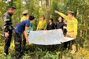
The Land Registration Office reviewed maps, built reference tables, assigned land parcel ID codes, and submitted them for data conversion, while also re-checking and categorizing cadastral data. Among the eight localities with existing cadastral data, only Mường Lay Ward falls under Group 2 (having data but requiring updates and verification), while the remaining seven communes and 37 others fall under Group 3 (lacking exploitable data and requiring complete reconstruction).
Local land registration branches are continuing to work with commune police to update and verify land-user information to ensure the database meets the standards of “accurate, complete, clean, and active.”
In Sáng Nhè commune, the campaign has set clear objectives: collecting, digitizing, and updating data on land-use rights and housing ownership certificates. The commune People’s Committee established a steering committee, assigned tasks, and dispatched working teams to villages to guide residents in preparing required documents such as land-use certificates, house-ownership certificates, and citizen ID cards. The scanning and data-entry process is carried out carefully to ensure precision and confidentiality. The commune also promotes public communication, encouraging residents to actively cooperate, verify their information, and promptly report difficulties.
After nearly one month of implementation, while many localities have shown strong initiative, 13 communes and wards have yet to form their steering committees. Notably, Điện Biên Phủ and Mường Thanh wards, which have large and complex workloads, have been slow to act. Điện Biên Phủ ward has not yet established its committee, while Mường Thanh Ward remains in the planning phase.
Ms. Dương Thị Minh Dịu, Director of the Land Registration Office under the Department of Natural Resources and Environment, affirmed: “This campaign is a crucial step in the province’s digital transformation process, helping to improve state management efficiency in land administration. It also enhances public service quality, shortens administrative procedures, and enables online processing for citizens and businesses. Once standardized, the provincial land database will be integrated and synchronized with the national land database and related sectors, ensuring seamless operation and effective use of digital resources.”
She emphasized that local governments must strictly follow the schedule, ensure data accuracy and security, and complete the campaign’s objectives on time.
Phạm Trung
.jpg)

.jpg)
.jpg)
.jpg)
.jpg)
.jpg)
.jpg)


.jpg)
.jpg)
.jpg)
.jpg)
.jpg)
You have 500/500 characters left
Please enter 5 or more characters!!!