
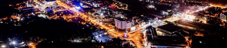


Through more than eight decades of establishment and development, from rudimentary observation stations to a modern network, the Hydrometeorological sector has increasingly affirmed its special role in natural disaster prevention and control, safeguarding the lives and property of the people, and serving socio-economic development. In Điện Biên, confronting the increasingly extreme and unpredictable vagaries of weather, elevating the quality of forecasting and early warning has become more pressing than ever.
81 years for the people’s safety
On October 3, 1945, President Hồ Chí Minh signed Decree No.41, laying the foundation for the Việt Nam Hydrometeorological sector. Since 2019, October 3 each year has been designated as the sector’s Traditional Day. The past 81 years represent an enduring journey of generations of hydrometeorological cadres - individuals who quietly stay rooted at observation stations, tracking every fluctuation of rainfall, storms, floods, and river flows so that forecast bulletins are transmitted promptly, contributing to safeguarding the peaceful lives of the people.
The message “Việt Nam Hydrometeorology - 81 years for a sustainable future” not only recalls traditions but also places new imperatives on a scientific branch that directly impacts livelihoods and development. Under conditions where climate change is increasingly pronounced and natural disasters unfold with great complexity, hydrometeorological information does not merely serve to tell whether “tomorrow will be sunny or rainy,” but has become an indispensable data source for guidance, administration, spatial planning, and production organization.
.png)
Điện Biên is a mountainous province with complex topography, heavily dissected by high mountain ranges, valleys, and river and stream networks. These characteristics mean that localized heavy downpours, floods, whirlwinds, severe and damaging cold spells, frost, hoarfrost, or intense heatwaves can generate major impacts within localized perimeters and unfold very rapidly.
The Điện Biên Provincial Hydrometeorological Station manages a network comprising one weather radar station, one radiosonde station, four surface meteorological stations, three basic hydrological stations, and 11 automatic rainfall stations. These serve as vital links in the monitoring and data acquisition network, supporting natural disaster forecasting and early warning across the locality. In 2026, hydrometeorological forecasting essentially satisfied requirements serving disaster prevention and control, aiding command and administration, and helping mitigate risks.
Nonetheless, challenges mount as climate change causes numerous extreme weather patterns to increase in both intensity and frequency, with certain rainfall values and water levels breaking historical records. Concurrently, rapid urbanization, infrastructure expansion, and escalating demands in disaster prevention and mitigation necessitate forecasts that are faster, more accurate, and more detailed.
From weather forecasts to development data infrastructure
The value of hydrometeorology today extends far beyond the scope of a daily weather bulletin. Data on precipitation, temperature, humidity, water levels, and hydrological discharge are integrating ever deeper into master planning, formulating socio-economic development plans, and organizing production.
In agriculture, hydrometeorological information supports establishing crop calendars, restructuring crop patterns, proactively securing irrigation water, and curbing the fallout of adverse weather. In irrigation and water resources, metrics on rainfall, water levels, and river discharge provide crucial baselines for operating reservoirs and drainage networks, while ensuring the safety of engineering works.
.jpg)
Across transportation, construction, and tourism, accurate forecasts enable units to proactively select construction windows, organize transport, and guarantee safety for travelers and residents. Coupled with requirements in construction planning, land use, and disaster prevention, hydrometeorology is progressively becoming an integral component of information infrastructure serving development.
This necessitates an evolution in approach. A sound bulletin must not only be accurate, but arrive at the right time, reach the right locality, remain easy to comprehend, and possess sufficient utility to guide users in decision-making. For a province with complex relief like Điện Biên, broad-area forecasts must progressively be supplemented with detailed products tailored to specific microclimatic zones, particularly concerning localized heavy rains, thunderstorms, whirlwinds, floods, and inundation risks.
Practical experience reveals that forecasting torrential rains and floods still faces hurdles at times due to rapid, erratic weather evolutions; the observation network in certain areas remains limited; and information dissemination and telecommunications maintenance during severe weather occasionally hit obstacles. Accurately pinpointing these limitations provides the foundation for continuously enhancing forecasting and early-warning capacity.
More accurate, faster, and aligned with reality
Confronting new requirements, the provincial Hydrometeorological sector determines to deploy synchronized solutions: reinforcing observational discipline, tightly controlling data quality; elevating bulletin quality and tracking severe weather phenomena closely; and stepping up the application of technology, digital transformation, and artificial intelligence in analysis, forecasting, and early warning.
Alongside this is the imperative to continue modernizing the monitoring network, perfecting the hydrometeorological database and information system; and enhancing coordination between specialized agencies and reservoir management units, provincial departments, sectors, and local authorities. Forecasting data genuinely yields value only when translated into concrete preventive actions at the grassroots.
While modern technology expands observational capabilities and data processing, human expertise remains the decisive factor governing forecast quality. Therefore, alongside equipment investment, training and developing a contingent of cadres equipped with professional competence, a high sense of duty, and mastery over technology must be given prime importance.
Every citizen is also a link in the risk-prevention chain. Proactively tracking information from official sources, adhering to functional agencies’ recommendations, and honing disaster response skills serve as the conduit to transform early warning bulletins into protective actions for oneself, family, and community.
Eighty-one years of building and maturing provides the foundation for the Hydrometeorological sector to embark upon a new developmental phase. For Điện Biên, upgrading monitoring, forecasting, and early-warning capacity is not merely the technical duty of a single sector, but a direct requirement for sustainable development. When each line of data is captured with greater precision, each bulletin is dispatched earlier, and each warning arrives where it is needed most, proactive disaster preparedness will be heightened.
Being proactive from hydrometeorological intelligence is proactively protecting today’s livelihoods while forging a secure foundation for tomorrow’s development.
Phương Hoa
.jpg)

.jpg)


.jpg)
.jpg)
.jpg)

.jpg)
.jpg)
You have 500/500 characters left
Please enter 5 or more characters!!!